Boston North Shore Study
Regional Saugus River Floodgate Project - Everett, Lynn, Malden, Nahant, Revere and Saugus, Massachusetts

Problem Identification
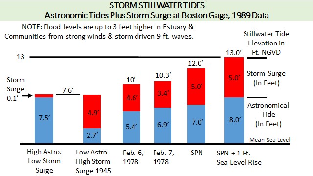
Blizzard of '78
4,000 evacuated; 10,000 residents & 20,000 employees & 400,000 commuters affected.
Homes burned as roads not accessible. Almost $300 million in recurring damages.
Today frequent flooding and higher storm levels aggravates residents due to increases from 1/2 foot of sea level rise since '78. Forecasts estimate that in 15 years another 1/2 foot in rise would cause the '78 Blizzard to become a 10-year frequency event.


The risk of up to a 5-to-8-foot rise in sea level over the next century would be devastating to the region.
Coastal storms are frequently accompanied by powerful and sustained winds, which may last several days, with 9 foot wave heights in Broad Sound, that drive flood waters into the Estuary and Communities up to 3 feet higher than stillwater tide levels.
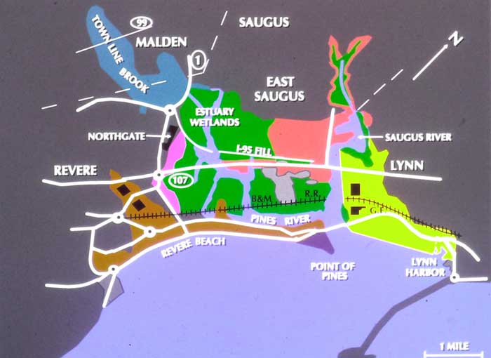
Project Area Floodplain
4 Communities: 5,000 buildings; 8,000 housing units; over 10,000 residents; 20,000 employees; 400,000 commuters; 30 miles of shorefront structures; 400 commercial and recreational vessels; 1,650 acres of salt-water Estuary; and major arteries: US #1, 1A, 107, MBTA Blue Line and B&M Commuter Rail.
|
|


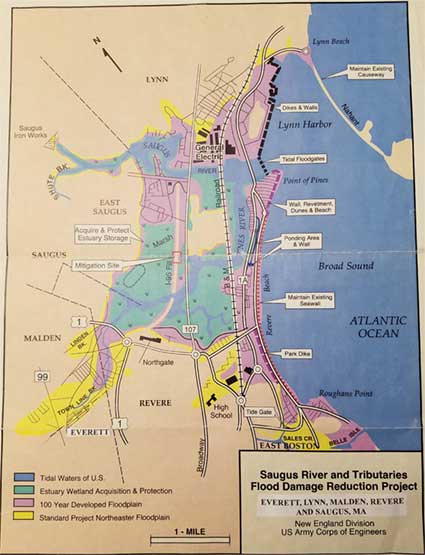
Floodplain Map: This map delineates the 100-year (1978) floodplain and
the Standard Project Northeaster floodplain, as well as location of Project features.
